National Register Action Update

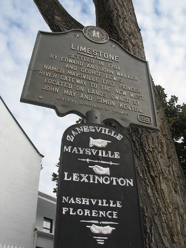
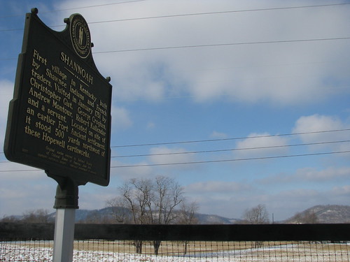
In December, we posted on the nomination of five Kentucky sites to the National Register of Historic Places. Over the past week, each of the five became listed on the register.

Additionally, a sixth Kentucky site was added to the National Register. The Joseph Crockett House – an “old stone house on the banks of Hickman Creek” [*] in Union Mill, Jessamine County in 1803 was also added to the Register.

Crockett came to Kentucky in 1784 and was involved in Kentucky’s statehood. Lt. Crockett received a land grant of 1900 acres for his service in the American Revolution and began the Union Mill community and built its first gristmill. In 1801, President Jefferson appointed Crockett to be the U.S. Marshall and he served in that capacity for about eight years. One of Crockett’s most famous acts as a Marshall occurred in 1806. Joseph Hamilton Daviess, the U.S. District Attorney for Kentucky, had Crockett serve Aaron Burr with the government’s charges of treason. (Burr was acquitted at trial; his attorney was Henry Clay.) Crockett died in 1829. There are a lot of other fascinating stories about him (so I’ll do a full post some other time…).

The other sites added to the National Register are the J. Hawkins Hart House in Henderson, Henderson County, the Jenkins School in Jenkins, Letcher County as well as three sites in Louisville (Jefferson County): McBride’s Harrods Creek Landing, Miller Paper Company Buildings and the Most Blessed Sacrament School.

NoD: Limestone (n/k/a Maysville)

Maysville, KY
Waymarking Sign, Maysville, Ky.

Lexington’s Limestone Street travels north to merge with Paris Pike and its history is there forgotten. Ultimately, you can take the road all the way to the Ohio River at Maysville. And Limestone Street was once aptly named since Maysville was formerly known as Limestone. Limestone was first settled in 1784, the road to Lexington (an old buffalo trace) was almost immediately established. [*]

In 1787, Limestone was formally established by the Virginia General Assembly which changed the name of the community situated at the confluence of Limestone Creek and the Ohio River to Maysville. At the time, Limestone/Maysville was part of Bourbon County (and was until Mason County was created in 1789) and was a key riverport for the bourbon whiskey industry.

By 1833, Maysville was a thriving riverport and was made the county seat of Mason County in 1848 (it was a contentious vote, as Washington was previously the county seat). The name “Limestone” was used to identify the community until the mid-nineteenth century as well.

What is Lexington? A (Geographically) Broader View

As previously mentioned, I have been named to the board of ProgressLex. Below is an excerpt from my first post on their blog, which appeared today. 

Lexington, Ky.By both its name and mission, ProgressLex is an organization dedicated to “creating and sustaining a thriving, diverse and beautiful Lexington.” But what is Lexington?


For some, Lexington ends at New Circle Road. Others draw the line at the Urban Service Boundary or the Fayette County line. The Census Bureau has recognized the Lexington-Fayette Metropolitan Statistical Area to include all of Bourbon, Clark, Fayette, Jessamine, Scott and Woodford counties. 


Though we sleep in our bedroom communities, many of the citizens in these adjacent counties work and play in Lexington. We eat in downtown restaurants. We buy our produce at the Cheapside farmer’s market. (And for those of us who work in Lexington, we pay Lexington’s income tax.) We care about the environment and social justice. The residents of the neighboring counties have an important role in making Lexington what it is and should play a role in determining Lexington’s future.


You can read the full post at the ProgressLex website.

NoD: Nor’eastern Kentucky

Northeastern Kentucky
Nor’eastern Kentucky

Greenup County is the most northeastern county in Kentucky as the Ohio River makes up its eastern and northern border. So in true No Destination spirit, I set out to go on Kentucky’s most northeastern road. Turns out, that is Hardin Lane. Snow covered and a little icy (especially for my Honda Fit), the road was beautiful. It seemed completely isolated, its flat farmland match by the rolling hills of southern Ohio across the river.

Apparently, switch grass is grown on some of this farmland; while driving I heard on  the radio that additional studies were needed to determine if this native vegetation is as efficient as coal as an energy source.

The map to the left shows where this road is – right off Route 23. Old tractors, chicken coops and other farming sites dot this little offroad. Check out my other flickr pictures of this little jaunt.

NoD: Shannoah

Shannoah
Shannoah Historic Marker, Greenup Co., Ky.

Following a flood destroying the Shannoah community on the north bank of the Ohio River, the Shawnee Indians came into Kentucky in 1750 and established a village by the same name. [*] At the time, the French laid claim to what would become central Kentucky as it claimed the entire Ohio River basin. Obviously, this would become one of the disputes between the French and the British which led to the French & Indian War.

Kentucky historic marker #31 reads:

First village in Kentucky built by Shawnee Indians and French traders. Visited in January 1751 by Christopher Gist, George Croghan, Andrew Montour, Robert Kallendar and a servant. Located on the site of an earlier Fort Ancient settlement, it stood 500 yards northwest of these Hopewell earthworks.

The journal of Christopher Gist is a significant resource that tells of the 1751 visit to Shannoah by Gist and his colleagues. He “killed a fat Bear” on March 6, 1750. Gist would later guide Major George Washington on missions during the French & Indian War.

At the time of Gist’s visit, inhabitants of Shannoah numbered 300 men in about 40 houses. [*]

NoD: U.S. Grant Bridge

U.S. Grant Bridge
U.S. Grant Bridge spans the Ohio River; Greenup County, Ky.

A spectacular bridge spans the Ohio River at South Portsmouth, Kentucky (and Portsmouth, Ohio) and carries U.S. 23 traffic to and from Kentucky. The current bridge opened to traffic on October 16, 2006, after five years of construction. The original U.S. Grant Bridge was built in 1927 and was demolished in 2001.

Named after General (and later the eighteenth President) Ulysses S. Grant, the bridge is a cable-stayed bridge that cost over $38 million to construct. The two-lane bridge is 2,155 feet in length. [*] Check out these other pictures of the US Grant Bridge!

Stop the Demo of Whiskey Row

Whiskey Row, Louisville, Ky.

Local neighborhoods activist Hayward Wilkirson penned a terrific piece for ProgressLex warning about the struggle to preserve an area of downtown Louisville known as Whiskey Row:

a collection of seven historic buildings (most of a city block) listed on the National Register of Historic Places and protected by the Louisville Historic Landmarks Commission.  These buildings, some of Louisville’s most significant architectural treasures, comprise the largest cast-iron-fronted building district outside of Soho in New York City.

Truly a unique and beautiful set of buildings obviously in need of great repair, developer Blue wants to demolish the buildings apparently with no plan for what should come next. Wilkirson and others have labeled this “Louisville’s Centerpointe.” The buildings have been labeled by local and national registers as historic so that extra steps must be taken before any demolition can occur. Without these requirements being fulfilled, Louisville Mayor Greg Fischer appears to have given the go ahead for demolition.

I rarely make it to Louisville, but I do remember driving down its Main Street a few years ago and thinking about how terrific it would be if this great group of mid-nineteenth century buildings were restored and reused. Now it is time to either sink or swim.

ProgressLex

I apologize to my readers that I haven’t been actively posting these last few weeks, but I have been busy with work and have preferred spending my spare time driving and photographing rather than writing. I’ll try and post soon. Also taking up my time is my appointment to the board of directors of ProgressLex, a community organization committed to making Lexington the greatest city it can be. I’ll also be posting there from time to time, so check it out.

At ProgressLex, I’m taking a more regional approach than my colleagues because I believe Lexington is more than just the area within New Circle, the Urban Service boundary or even the county line. It is a good organization dedicated to promoting design excellence, economic growth, and greenspace preservation (which, as you know, are all areas on which the Kaintuckeean tends to focus – so long as design excellence includes historic preservation). Again, check it out!

NoD: Jack Jouett, Jr.

IMG_5344
Jack Jouett Historic Marker, Owingsville, Ky.

Henry Wadsworth Longfellow’s immortal poem begins, “Listen my children and you shall hear of the midnight ride of Paul Revere.” His words “one if by land, two if by sea” captured forever Paul Revere into America’s folklore. He is believed a great father of American independence.

But what of the other hero who made a similar ride? In early June 1781, Jack Jouett – asleep in Cuckoo, Louisa County, Virginia – heard British troops and quickly determined their destination: Charlottesville. Jouett took to his horse and rode the 40 miles to warn Governor Thomas Jefferson and the legislature (which had been convened in Charlottesville due to Benedict Arnold’s taking of Richmond).

Arriving hours before the British, Jouett first rode to Jefferson’s home, Monticello, where he successfully warned the Governor and those legislators staying there. Jouett then rode the additional two miles to Charlottesville and warned the balance of the legislature. All but seven legislators successfully escaped thanks to Jouett’s heroics. (Jefferson leisurely stayed at Monticello and escaped himself by horseback with only second to spare, but Jouett definitely warned him!)

Soon after, Jouett moved to Kentucky County. Passing a cabin on his way through the Wilderness Pass, Jouett hears a woman scream. He broke into the cabin only to find her being beaten by her husband and began to separate the two, but the woman defended her husband by taking a cast iron skillet to Jouett’s head. Fortunately, the skillet was of low grade and the bottom fell through, but Jouett rode on until he could find a blacksmith to release the remainder of the pan from his head. [*]

Settling first in what is now Mercer County, Jouett ultimately moved to Woodford County. He served in both the Virginia and Kentucky legislatures on behalf of Kentuckians and he aided in Kentucky’s first constitutional convention. He died while visiting his daughter in what-is-now Bath County and was buried in an unmarked grave at the “Peeled Oak” farm.

walkLEX: 111 West Main Street

111MainSt     111MainSt
Removing the Facade circa 1920

On the first Sunday of 2011, I stopped to turn left onto Main Street from South Limestone and noticed the facade of 111 West Main Street being removed. I snapped the picture in an attempt to remember the boring facade – which is all I’ve ever known of this building which is occupied by the Sunrise Bakery. The work being done on this block is extensive; check out my prior post on 123 West Main.

According to the historic pictures of the Asa C. Chinn Collection, the property used to (c. 1920) house the Met Restaurant (111), Vacant (109) and confectioners Vrondis & Mehas (107). Vrondis, however, seems to be the main attraction based on signage visible in 1921, which read “L.C. Vrondis / Soda / Five Cents.” L.C. Vrondis was likely Larry C. Vrondis (3/28/1888 – 7/12/1961), SGT HQ Co 159 Brig USA, who is buried at Camp Nelson in Jessamine County. It is also worth noting that UK’s 1922 yearbook, the Kentuckian, contains an advertisement noting the Larry Vrondis Co. as the proprietor of the Savoy Restaurant (per the ad, “The Stopping Place for University People” and “Open Day and Night) which was located next door at 105 West Main Street. It seems that a little more research on Mr. Vrondis might reveal some interesting findings. Anyone care to do some research??