No Destination: Main & Cross Main (Main Cross)

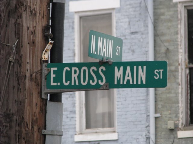
Intersection of Main & Cross Main in New Castle

Pictured above is the sign marking the intersection of N. Main St. and E. Cross Main St. in New Castle, Kentucky. Historical significance: none of which I am aware. So why the picture and the post?

Well, you’ve probably figured out I love strange historical facts and findings. A common street design in this area was to have a Main Street with a “Cross Street” (aka “Cross Main” or “Main Cross”). The road was traditionally the main road to run perpendicular to Main Street. Why the picture? Because I’ve never noticed a street sign bearing the name.  Lexington’s “Main Cross Street” is now Broadway. Nicholasville’s “Cross Street” is now Walnut Street.

New Castle’s isn’t the only remaining “Cross” street. A quick google reveals several in Ohio and another in Louisa, Kentucky (Lawrence County).

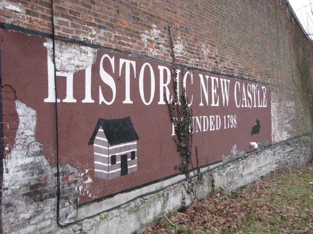
No Destination: New Castle

New Castle, Kentucky

Marketed as “life in the s-l-o-w lane,” New Castle was founded in 1798 and incorporated in 1817. It has always been the county seat of Henry County. From its website:

The view from this Henry County “seat” hasn’t changed much in 200 years. Local traditions linger , even with Louisville just 35 minutes down the road. New Castle (pop. 919) is one of the smallest towns in Kentucky certified in both “Renaissance on Main” and “Preserve America” programs; we tend to our town with the same grit and teamwork it takes to farm. Nothing fancy here–a busy courthouse square, a few characters and a lot of lawyers (15 at last count.).

So in the past 200 years, not much has changed in New Castle. Except that there are more lawyers.  As for the origin of the town’s name, it is unknown. (Per Wikipedia and, more importantly, the Kentucky Encyclopedia.) I would suggest it is named after my favorite beer, Newcastle Brown Ale. The ale, however, wasn’t created until 1927 so I doubt that is correct.

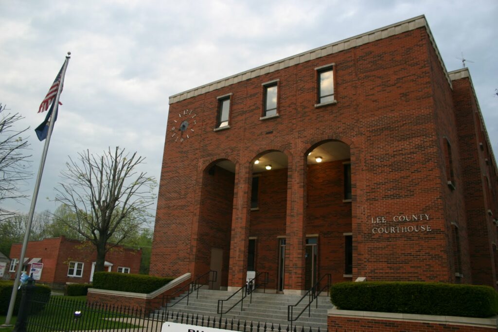
Lee County Courthouse – Beattyville, Ky.


As I have mentioned before, my wife’s family is from Whitesburg, so I frequently find myself in Eastern Kentucky. I noticed the last time that I put up an update on my status that I had inexplicably failed to make it Lee County, which seemed like a huge hole in my map. So last evening, I was headed to Jackson to meet the in-laws halfway, and I decided that on the way back we would swing through Beattyville instead of Campton.
The drive from Jackson to Beattyville is spectacular. State highway 52 runs parallel to the railroad tracks, and the tracks run a considerable height above the roadway. This means that occasionally, a few really amazing old tunnels run underneath the tracks. I’ve never really driven side roads through the mountains, and after this trip, I can highly recommend it. The roads might be a little crazy at times, but you get a completely different experience than the one you get sticking to the Mountain Parkway.
Beattyville reminds me a lot of Morehead. The Main Street areas are just very similar. I’ve recently become a big fan of the Kentucky Explorer, a really interesting little magazine full of history and photos. According to a recent issue, Beattyville had a population of 400 in 1879, with a 4 lawyers, a couple of general stores, several hotels, a flour mill and a grist mill.
When I came up to the courthouse square, I immediately noticed a couple of buildings across the street that looked like they had been pretty heavily damaged by fire. I had forgotten about the Beattyville fire of 2009, which destroyed an entire block of the city that sits across from the courthouse pictured above.
So I was taking my pictures and walking around the courthouse square when I noticed a sign that stated that Beattyville is a part of Homeland Security initiatives, and any suspicious activity would be reported to local authorities. I started to ask myself what sort of suspicious activities might be happening in Beattyville, when the realization struck me that a stranger taking pictures of the courthouse was probably pretty unusual. So I got in the car pretty quickly.

No Destination: Gen. William O. Butler

Born in Jessamine County, General William Butler was a Mexican War hero who practice law and ultimately died in Carrollton.

The Presidential election of 1848 was full of Kentucky connections and is evidence of Kentucky’s political prowess of old. In the race, Zachary Taylor (interred in Kentucky) defeated Kentuckian Henry Clay for the Whig nomination. In the general election, Taylor/Filmore defeatedthe Democratic ticket of Cass/Butler.

Significantly, Butler represented Kentucky in the oft-forgotten 1861 peace conference which took place in Washington, D.C. as an attempt to stave off civil war. Another Kentuckian, Senator John J. Crittenden, emphasized his crazy proposals for six Constitutional amendments to prevent war. Of course, Crittenden would have permanently recognized slavery in the U.S.

Kentucky Historical Marker #634, the only state historic marker on the Carroll County courthouse lawn, reads:

Gen. William O. Butler, born Kentucky 1791, died here, 1880. War of 1812: River Raisin, Pensacola, and New Orleans. Gen. Andrew Jackson’s staff 1816-17. Cited for heroism in Mexican War 1846-48. Practiced law here. Congressman 1839-43. Defeated as candidate for Governor 1844, Vice President 1848 and US Senate 1851. A Kentucky Commissioner to Peace Conference in Feb. 1861.

Named after General Butler is a state park just southeast of Carrollton, as well as counties in both Iowa and Missouri.

No Destination: Carrollton

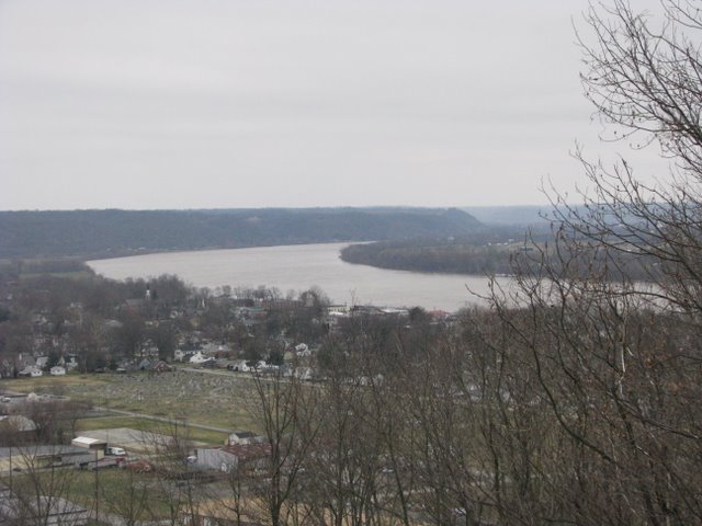
Carrollton, as viewed from the Observation Deck at General Butler State Park

Port William, Kentucky became the county seat of Gallatin County when the county was formed in 1799. In 1938, the county was divided to create Carroll County. At that time, Port William was renamed Carrollton with the new county and its seat being named after Charles Carroll (a signer of the Declaration of Independence from Maryland). Upon the death of Thomas Jefferson and John Adams (both died on July 4, 1826), Carroll was the last remaining signer. He died in 1832. [cite and cite]

Carrollton is a nice river town with a beautiful courthouse. The walk approaching the courthouse is tree-lined and quite stately. Much of Carrollton/Port William’s early history centered on Water Street. This street, located between Main Street and the Ohio River, is largely washed away due to changes in the path of the river.

In fact, much of downtown Carrollton was submerged during the flood of 1884: “[t]he swelling continued, and by Thursday evening the north half of the Court house yard was deep enough to row a boat in.” [cite] For those who haven’t been to Carrollton, let me give some perspective. The remains of Water Street are perhaps 18 inches above the river; Main Street runs parallel to Water Street but is probably twelve feet higher in elevation. The ground rises across Main Street, on the south side of which rests the courthouse. And the lawn is large. This was a big ol’ flood.

No Destination: Bedford’s Jail

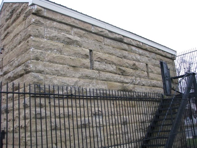
Old Trimble County Jail

Nate says that, “Trimble County is an interesting place.” It is pretty, and I hear that Milton is a neat river community. I hope to come back to visit it. Trimble County’s terrain is neat – the water levels were high on our mid-March visit. At times, it almost felt as if you were on a bridge in Louisiana’s low country.

Trimble County’s seat of government, Bedford, isn’t too interesting. (Yes, I know. I said negative things about Somerset, too – which started a storm of controversy. Well, on this blog a sprinkle turns out to be a storm.) As was the case with Somerset, I’m sure that there is a “finer side” to Bedford. I hope so – and I hope to see it.

The one really cool thing was the old jail. The jail pictured above was built in 1850, the same year that Bedford was incorporated. The second floor was added in 1899. As you can see from the picture, the jail (even with a second story) was incredibly small. But apparently, larger facilities were not needed.  From John Strother’s History of Trimble County, as read before the Filson Club on February 2, 1920:

This condition results in a steady, intelligent, law-abiding citizenship, unexcelled anywhere in Kentucky.  It is no unusual thing for the doors of the County Jail to stand wide open for a year or eighteen months at a time without a single prisoner.

Certainly, though prisoners would have become more frequent through the 1920s, the 1920s, the 1940s, the 1950s, the 1960s and the 1970s. In fact, this small jail – gothic, imposing and frankly quite frightening – served Trimble County until 1983.

No Destination: Westport

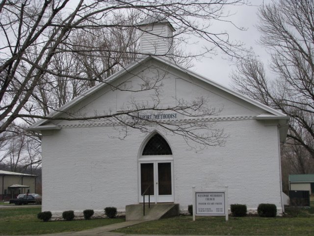
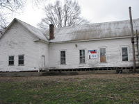
The Old Courthouse in Westport is now Westport Methodist Church.

Along the Ohio River in Oldham County lies Westport. Westport’s layout and design are very unique as it is designed around a large commons – a grassy area reminiscent of colonial New England. In fact, I imagine that walking through Williamsburg, Virginia pre-Rockefeller’s restoration was similar to walking through Westport. I am not the only person who has experienced this kind of feeling after experiencing Westport.

The streets, the buildings, and even the trees themselves seem to cling proudly to the importance that was theirs in the time of flourishing river traffic. For it was the river that gave birth and life itself to the town.

–from “Westport” by Helen Fairleigh Giltner, 1947 [Source: Courier-Journal]

Today, the historic structures are in various states of repair/disrepair, but the Friends of Westport are working tirelessly to restore this little hamlet. Their current project is the Westport Schoolhouse.

Westport Schoolhouse

The Westport Schoolhouse, pictured at left, was erected in 1882 and is the only remaining one-room schoolhouse in the state that sits on a town square. The renovation, which is at risk due to state budgetary issues, would result in a community center for arts and education. [Source: WAVE3]

Baptist minister Elijah Craig, now of bourbon fame, received from Virginia a 300 acre land grant in 1780. His grant included Westport. When Oldham County was carved from Shelby County in 1823, this rivertown was named the county seat and served in that capacity until 1838 when the county seat was permanently moved to La Grange (with the exception of about a month in 1827 when La Grange was selected by voters as the county seat, but state officials soon thereafter returned Westport to the position of prominence under political pressure). When county governance left Westport for good in 1838, the courthouse (pictured at top of post) was deeded to the Baptist, Christian, Methodist and Presbyterian churches. The courthouse still stands today and is utilized by the town’s Methodist congregation.

No Destination: Kentucky’s Tallest Structure

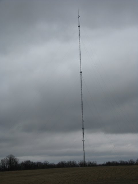
WAVE-3 Tower

In Lexington, we have the Lexington Financial Center (410 ft). In Louisville, there is the AEGON Center (549 ft). These are the tallest buildings in Kentucky’s largest cities.

But in Oldham County stands the state’s tallest structure. The WAVE-3 broadcast tower, constructed in 1991, is the state’s tallest structure standing at 1,739 feet. For some perspective, the World Trade Center was 1,727 feet. Chicago’s Sears Tower (nka Willis Tower) is only 1,451 feet.

That’s right. There stands a structure in Oldham County, Kentucky that is taller than even the World Trade Center.

But it gets taller. The tallest broadcast tower is in Blanchard, South Dakota (KLVY tower, 2,063 ft). The tallest building/manmade structure is the Burj Dubai at 2,717 ft. Still, if you wanna see something crazy tall – come to Oldham County.

No Destination: State Reformatory

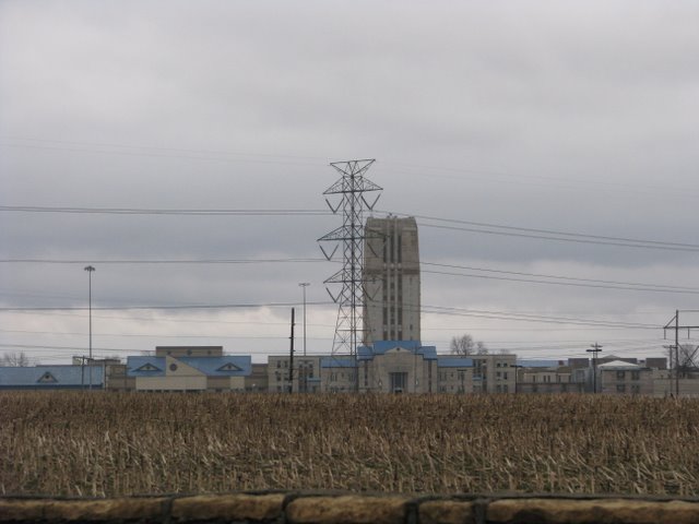
Administration Building of the Kentucky State Reformatory

Frankfort was once the home of Kentucky’s penitentiary, but it was moved to Eddyville in 1912. Left behind was what became the “state reformatory.” Overcrowding and a 1936 flood prompted Gov. Happy Chandler to seek the construction of a new Reformatory. Receiving $1 million from the state legislature and matching funds from the Public Works Administration, construction began on the La Grange facility in 1937. It opened in 1939.

The medium security facility houses about 2,000 inmates. The 12-story administration building is a great example of Depression Era, gothic-style architecture. According to the Oldham County Historical Society [PDF cite], the first ten stories housed offices and living quarters for staff, the eleventh floor housed elevator mechanics and the twelfth floor contained a now-unused 150,000 gallon water tank. (There is something quite illogical, however, of housing a water storage tank on top of mechanical/electrical systems.)