Cattletsburg Bank Collapses, Demolished

The Catlettsburg National Bank Building, at right
in 2010, collapsed on July 27, 2014. Author’s collection.

Early this morning, an exterior wall of a circa 1885 bank in Catlettsburg collapsed. About an hour and a half ago, demolition began.

I learned of this from Abandoned via Facebook:

(function(d, s, id) { var js, fjs = d.getElementsByTagName(s)[0]; if (d.getElementById(id)) return; js = d.createElement(s); js.id = id; js.src = “//connect.facebook.net/en_US/all.js#xfbml=1”; fjs.parentNode.insertBefore(js, fjs); }(document, ‘script’, ‘facebook-jssdk’));

The old bank was listed on the National Register of Historic Places (Caution: PDF). The application includes the following about the historic structure that is no longer part of Kentucky’s present:

Old Bank Building, late Victorian in style, was built by the Catlettsburg National Bank in 1885. Its outer dimensions are 33 feet by 100 feet. The stone walls of its basement are of pressed brick laid in diamond cement. Two stone lions flank the stone steps that lead to the recessed main door. The door is topped by a glass transom and framed by a brick archway. The windows were originally much higher; they extended to the arched brick lintels, and the pairs of windows at the extreme right and left of the enclosed photograph were originally single windows, with stained glass at the tops. The roofing material, Pennsylvania slate, is attractively arranged in a pattern consisting of curved and rectangular pieces. The ornate roof has dormers, spires, a minaret, and wooden embellishments. 

The Catlettsburg National Bank Building (aka Old Bank Building) was added to the 1973 at which time local historians felt “that if the building were properly restored, it would again be ‘altogether the handsome building in Catlettsburg.'”

In 2010, I visited Catlettsburg. The town is the county seat of Boyd County. The federal courthouse used to function out of Catlettsburg until it was moved to the larger city in the county, Ashland, during the 1980s. State court functions still operate out of the county seat. The first photo above is from that 2010 visit.

It was condemned in 2011 according to the Ashland Daily Independent. In February 2012, the same part which collapsed today collapsed and some repairs must have been made. As seen from Google Maps from April 2012:

Image of the Catlettsburg National Bank from April 2012 after a prior wall collapse.
Google Maps.

The George H. Bowman House is Gone but Not Forgotten

Bowman House - Lexington, Ky.
Bowman House – Lexington, Ky.

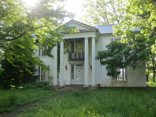
Earlier this spring, I spotted a sign in front of 4145 Harrodsburg Road indicating that a zoning request for the parcel would be from R-1D to R-1T. I rode onto the property, site of an abandoned home, to investigate further.

As it turns out, the residence was the George H. Bowman House, a ca. 1860 Greek Gothic Revival according to the Kentucky Historic Resources Survey conducted on the property in 1979.

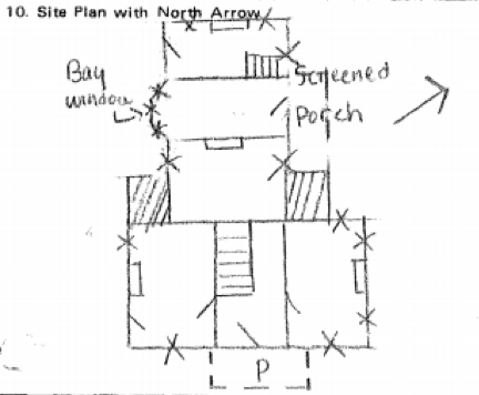
Site Layout of Bowman House
Layout of Bowman House (Source: Resources Inventory)

Property owners, according to early county maps, identify the owner in 1891 as John McMeekin who was the son of Jeremiah McMeekin. The elder was a butcher who had purchased Helm Place in 1873.

The owner in 1871 was J. S. Burrier, originally of Jessamine County, who acquired the home and 165 acres that year. He was married to Alice Craig, daughter of Lewis and Martha (Bryant) Craig.

It is believed that George H. Bowman constructed this house ca. 1860, though he remained only a few years. After inheriting Helm Place from his father, pioneer Abraham Bowman, George H. was forced to sell much of his inheritance to satisfy a gambling debt.

A. J. Reed took advantage of the younger Bowman’s misfortune and acquired the Helm Place property in 1859. It is believed that our subject house was built for George’s occupancy after the liquidation of Helm Place. Within the decade, George H. Bowman had passed away and his children divided and sold their father’s property.

Back to the present. The zoning change mentioned permitted the demolition of the Bowman House and the erection of four townhouse units in its place. It is worth noting, however, that the data relied on in the Map Amendment Request (MAR) included inaccurate data from the Fayette County PVA office.

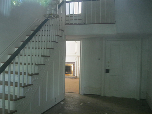
The existing house was build in 1940, according to PVA records. Unfortunately, since the grant of the previous zone change (and prior to the purchase by the applicant) the house has fallen into a state of disrepair. There are structural issues relating to the foundation. Also contents and mechanical systems of the house have been torn out by unknown persons. Exterior decay issues are present. For all these reasons, it is impossible to preserve the house. (MARV 2013-3 Amd.pdf)

Interior of Bowman House
Interior of Bowman House. Impossible to repair?

I truly doubt that preservation was an impossibility. Impracticable, perhaps. But not impossible. Several additional references existed in the MAR to the “1940 house.”

I have heard that the sitting PVA has plans to update historical property data to correct errors such as the one that may or may not have altered the decisions surrounding the Bowman House. In either event, this is a worthy cause and would be an excellent step forward by the Property Value Administrator and his staff.

I was glad to have snapped these pictures before the old Bowman House was demolished. (I’m assuming demolition has occurred – any updates to the project?)

NoD: Union Mill Bridge Down for the Count

Union Mill, Kentucky
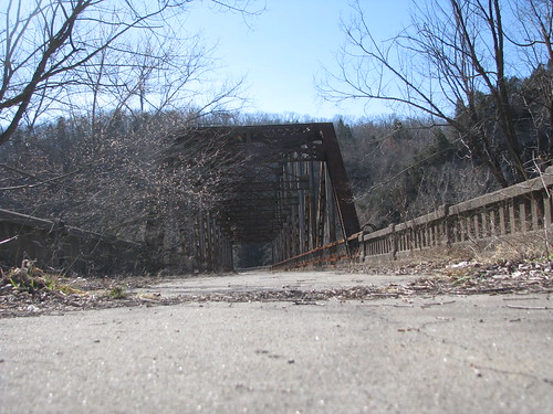
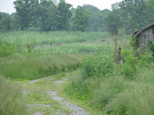
An Overgrown Union Mill Bridge;
Photo by George W. Dean
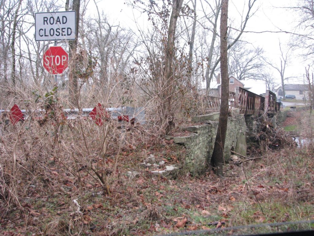
Site of the old Union Mill Bridge;

December 2011

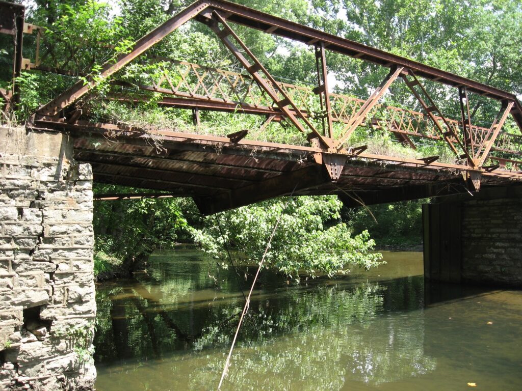
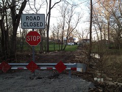
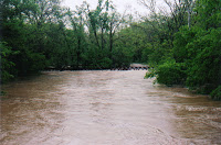
In 1915, raging flood waters took from the Jessamine County community of Union Mill its covered bridge. The bridge connected the two sides of this community and provided a link between Nicholasville and the Valley View Ferry. Almost immediately, the Jessamine Fiscal Court awarded the contract for construction of a replacement bridge to Lexington’s Empire Bridge Company. The new bridge was to be of steel truss at a price was $2,697.

Spring 2010;
Photo by George W. Dean

About forty years later, the 1915 bridge was abandoned when the road was rerouted slightly downstream. For over fifty years, the abandoned bridge experienced rising and receding waters as well as an annual vegetation that nearly hid the bridge itself. But the years took its toll. Photos by Magistrate George W. Dean reveals only 2 1/2 feet of bridge above the water leaving an entire “roadbed” submerged for several days during the floods in the spring of 2010 (see photo at left).

Following the 2010 spring floods, local authorities discussed what could be done to restore and preserve this nearly century-old Jessamine County landmark. Any repair, however, would only prove to be a short-term fix. So costs and the lack of potential reuse left leadership with tied hands. With a new bridge over Little Hickman Creek just yards downstream, safety could not be ignored.

As a result, the last weekend in November 2011, witnessed the removal of that old truss bridge which had spanned the Little Hickman Creek for nearly a century.

Sources: George W. Dean emails; Jonathan Parrish emails; Municipal Journal

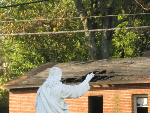
kernel: Jesus to Heal Jefferson Street Building Damaged by Fire

Jesus to Repair Fire - Lexington, Ky.

More after the jump…

Jesus to Repair Fire - Lexington, Ky.

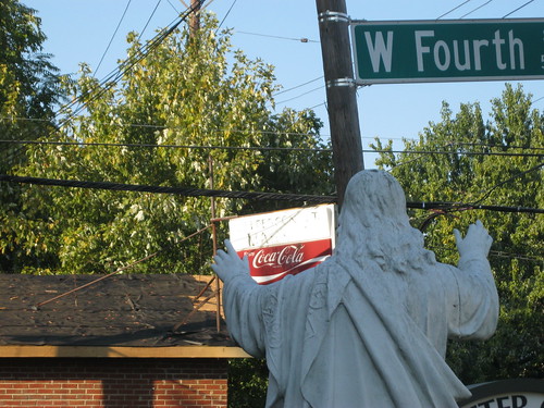
I was on a lunch walkLEX within a block of this building about four hours before the fire started. I trekked past the damaged market earlier this morning. According to reports (and here), the market operated for the latter half of the twentieth century in this predominately African American neighborhood. Across the street is St. Peter Claver Catholic Church and the pictured statue of Jesus; I couldn’t resist the juxtaposition.

 More photos of the fire damage are on flickr.

NoD: Rural Carriage House

Carriage House - Madison County, Ky.
Carriage House – Madison County, Ky.

When driving through Madison County earlier this year, I was struck by the number of “destinations” along U.S. 25 south of Richmond. Historic markers abound, a military complex is imposing, and this abandoned carriage house stands as a reminder of days gone.

I’ve previously written a series on the carriage houses of Lexington’s Gratz Park (series pts. 1, 2, and 3), but unlike those urban instances this carriage house appears in a rural setting. Although I cannot find any specifics on this carriage house at this time, I am hopeful that readers might fill in the gaps.

The carriage house is situated off a small private road adjacent to US25 (Berea Road), formerly the eastern portion of the Dixie Highway. It is probable that the private road was the original Dixie Highway and that the carriage house opened directly upon it. With two stories and large windows above each of the carriage ports, it is likely that living quarters were included above. The stately stone entrance to the drive reveals no great manor behind, likely the home to which the carriage house belonged has been lost to the annals of history. (Any help on the history here… por favor?)

Amazingly, the only reference to this carriage house I can find online comes from the Madison County Quilt Trail as the Star Shadows barn quilt can be seen behind the carriage house.

Oh… and check this out: I’ve added Lightbox to the blog.

 Carriage House - Madison County, Ky. Carriage House - Madison County, Ky. Carriage House - Madison County, Ky. Carriage House - Madison County, Ky.


Photos on flickr.

NoD: Camp Nelson Bridge (v. 2.0)

Camp Nelson
Abandoned Camp Nelson Bridge – Jessamine/Garrard Counties, Ky.

Three bridges have crossed the Kentucky River at Camp Nelson and the pictured bridge was the second installation having replaced a double-barreled covered bridge that  had carried travelers since 1838. Today, this abandoned bridge has been replaced by the less-scenic bridge that has carried four lanes of  US-27 traffic since 1971.

This steel truss bridge features two Pennsylvania-style trusses which span 275 feet over the Kentucky River; with abutments and approaches, the length is extended to 543 feet. When the waters of the Kentucky River are lowest, the bridge rises 60 feet above them. Over 600,000 pounds of structural steel were used for construction, including the 15,000 rivets connecting the I-beams. [*] Bridges are impressive structures and version 2.0 of the Camp Nelson trilogy doesn’t disappoint.

As with all things abandoned, it is a little eerie to walk onto the bridge — completely alone. The rusting trusses and fauna growing through cracks and clumps of dirt give a certain “Life After People” aura. But the spectacular views from this bridge, and the perspective of the three different Camp Nelson bridges is in itself a walk through history.

NoD: Hayswood Hospital

Atop the hill overlooking Maysville and the Ohio River rests the old HayswoodHospital. A massive and imposing structure that by all accounts is quite haunted, the old hospital has been an empty shell since 1983. As a result of almost thirty years of abandonment, it looks like something right out of the History Channel’s Life After People.


Built in 1915 (expanded in 1925 and 1971) atop the demolished remains of the even older Wilson Infirmary (which dated to the 1800s), the hospital closed with a patient capacity of 87 beds. Since its 1983 closure, a number of different ideas have been levied of what to do with the property – but currently only time and invasive species have bothered to invest.

The ghost stories are many and are well-documented (from AbandonedOnline.net):

According to several accounts, a woman carrying a baby was seen walking through the nursery area of the hospital. The woman, having died in labor, was soon followed by the newborn (4). Others have reported seeing doctors in the hallways and hearing the cries of its former patients, along with spotting lights in the windows. And the few have reported seeing strange markings in the basement that bestow a threatening hostility on whoever walks or drives by.

I would have ventured deeper into old Hayswood, but I was alone and had concerns about the buildings structural soundness. The pictures are so cool, I’ve embedded a slideshow and have included lots of links (most of which have even more awesome pictures).

No Destination: Griffith Woods

Griffith Woods
Griffith Woods, Cynthiana, Ky.

745 acres of protected Harrison County land provides the purest glimpse of what Europeans first saw when the entered the Bluegrass region. This is what the land looked like when the Native Americans lived here. Griffith Woods is a cooperative effort between the Nature Conservancy, the University of Kentucky and the Kentucky Nature Preserves Commission. It is the centerpiece of the Bluegrass Restoration Project, an effort dedicated to returning as much of the Bluegrass to its original state. This effort is particularly important as the Bluegrass region was listed as endangered in 2006 by the World Monuments Fund (of course, the WMF was referring to horse country, not the natural habitat).

Originally called Silver Lake Farm, both the farm and the Griffith family were key figures in the early days of both the Commonwealth and the county. In the early 1900s, owner and farmer William Griffith preserved a portion of his land which today stands as the largest oak-ash savanna in Kentucky. Many of the blue ash, chinquapin oak, bur oak, hickories and black walnut trees are over 300 years old. In fact, the world’s largest chinquapin oak is at Griffith Woods. Fenced off, except for private tours, the view above is from the gate. There is also an  abandoned home/tavern which was built around 1822.[*] It appears that UK and the Harrison County Fiscal Court might restore the tavern as well. Check out my other pictures of Griffith Woods @flickr.

What is the coolest ‘abandoned site’ in Kentucky?

This weeks SOS question asks “what is the coolest ‘abandoned site’ in Kentucky?

This past week, the Kaintuckeean has highlighted two abandoned sites in Jessamine County (the Union Mill bridge and the Boone tunnel). One of my favorites was the old school in Frenchburg. But there have been many more.

Anyway, have you driven past something on Kentucky’s backroads that was formerly something grander? A town that is now a ghost town? All of these sites add so much to Kentucky’s rich history and heritage. Please share in the comments below.

No Destination: Union Mill

Abandoned Bridge, Union Mill (Jessamine Co.), Ky.

The Jessamine County community of Union Mill (on KY-169) once was home to a successful distillery operation, one of several that used to operate in the county. The beautiful Hickman Creek (pictured below at right) provided the necessary moving water for both the distillery and the gristmill.

The first gristmill was constructed and operated by Joseph Crockett, a Revolutionary War veteran, around 1800. By the middle of the 1800s, the distillery was operating and bottling “Old Lexington Club Whiskey.” The mills produced “Hickman Lily” and “Snow on the Mountain” flour. But Prohibition shuttered the distillery, and the mill and community followed. [cite, PDF]

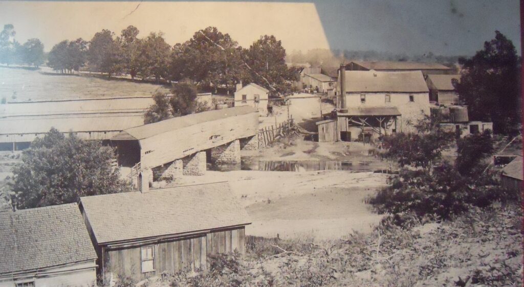
An old 150-foot covered bridge once traversed the creek. According to some reports the covered bridge was replaced in 1915 (see comments to this post), while other reports indicate it was lost in to flood waters in 1932. Still visible below the abandoned four-span, steel bedstead and pony truss bridge that followed is the original stonework from the covered bridge. [Kentucky’s Covered Bridges (KY) (Images of America)]. All of this was abandoned when, in 1955, KY-169 was rerouted slightly to the west.

UPDATE: Immediately below is a picture sent to me by the author of Kentucky’s Covered Bridges, Walter Laughlin, which shows the old covered bridge in its heyday.

Union Mills Covered Bridge
Photo Courtesy of Walter Laughlin


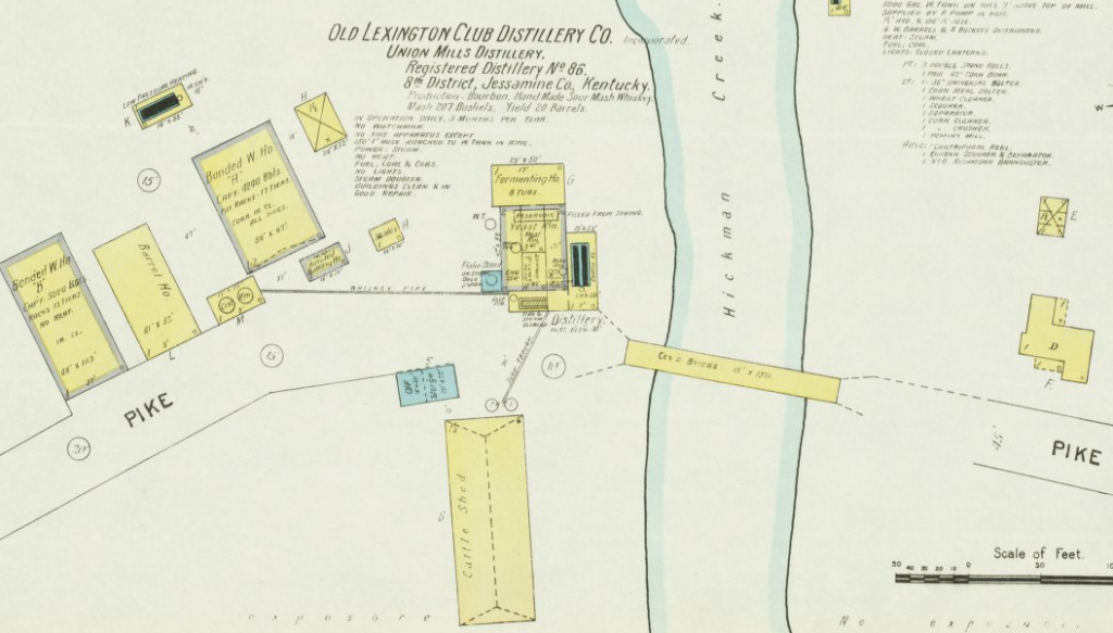
ANOTHER UPDATE: I’ve seen it before, but never added it. From the old Sanborn insurance maps comes this gem, circa. 1903. It identifies the pictured covered bridge and the different buildings related to the distillery. The distillery was in operation daily, five months out of the year. Yield was 20 barrels. See photo below:

Sanborn Insurance Map, ca. 1903 of Union Mill (Source)

Additionally, check out my post from December 2010 wherein I reported on the ultimate demise of the steel pony-truss bridge.