Depending on the region of Kentucky in which you leave, the concept of a flood differs entirely. To the western Kentuckian accustomed to acres upon acres of flat cropland near the Ohio River, rising waters inundate the soil. And while damaging, there is little surprising when rainfall and upstream gauges indicate what is to come. At the opposite end of the spectrum are the hollow valleys in eastern Kentucky where a flash flood can wash out all a family knows in a matter of second. There is no warning. Central Kentucky lies somewhere in between. Regardless of how the floodwaters impact you or your region, when the waters rise they can cause tremendous damage. To livelihoods, to buildings, to towns, and to the land itself.
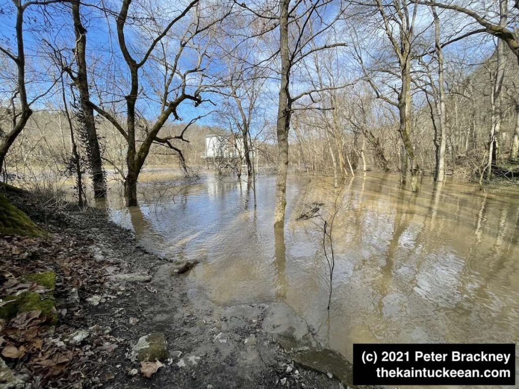
I have hiked Asbury Trails a few times so far in 2021. There was torrential rain on February 28, 2021, which led to significant flooding along the Kentucky River. I mean, significant. In the fall of 2020, the kids and I tossed rocks into the river from a rocky beach at the base of the Wilmore water intake. It’s been awhile since I’ve seen much of that little beach.
The water intake pumps were constructed in 1973 by Asbury University (nee College) before being transferred to Wilmore in 1977. In the picture below, you can see the intake pump near the center of the photograph. If you are familiar with these trails, you might notice immediately that the walking bridge is not in this focus as it is entirely submerged. Yeah.
For a closer look at the water intake – and for comparison for how things should look, I offer the following photograph from March 27, 2021:
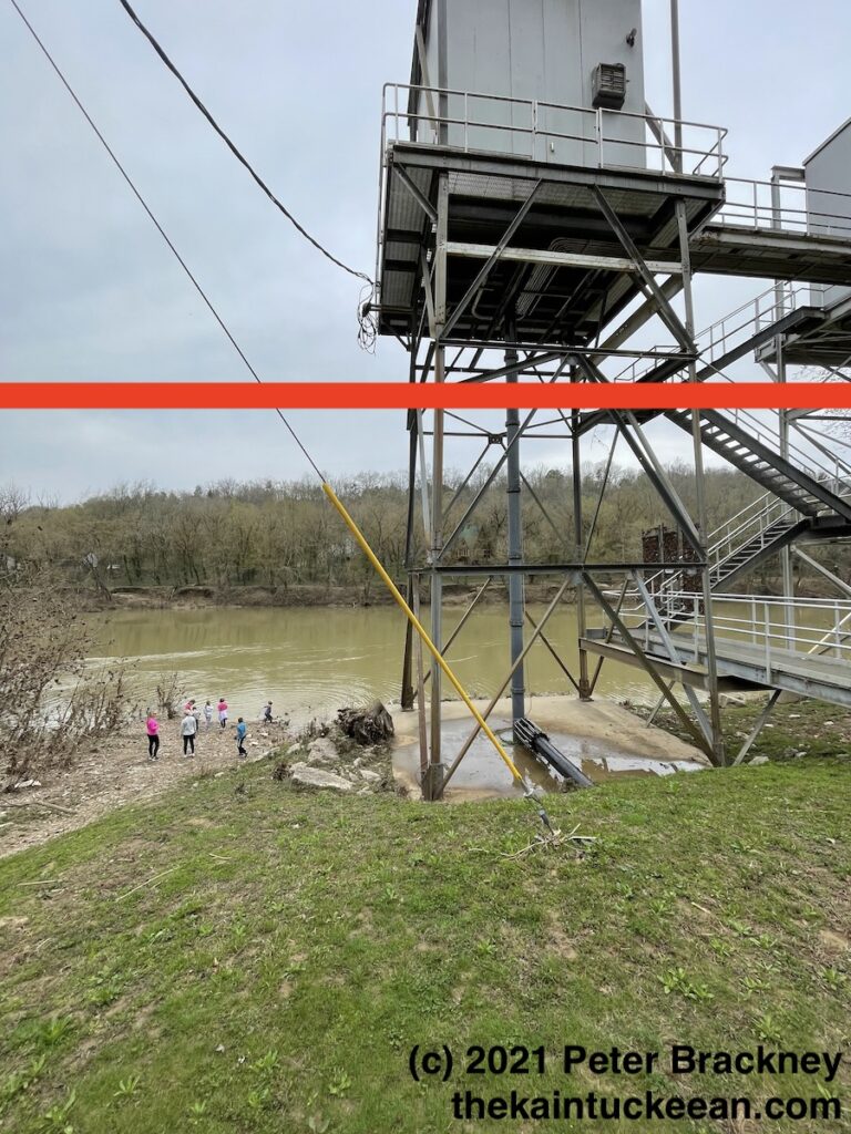
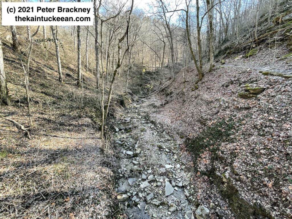
The red line indicates the high water mark that I personally observed earlier in March. From a different before-after perspective, the photograph immediately below is from early February 2021. The rock and leaf covered creekbed runs through the center of Asbury Trails. The second photograph shows the destruction caused from the late February rains. Remember that in both pictures, I am standing on a bridge that was completely submerged during the days of the rising waters.
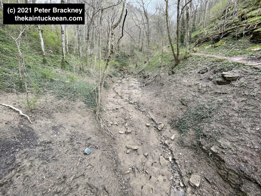
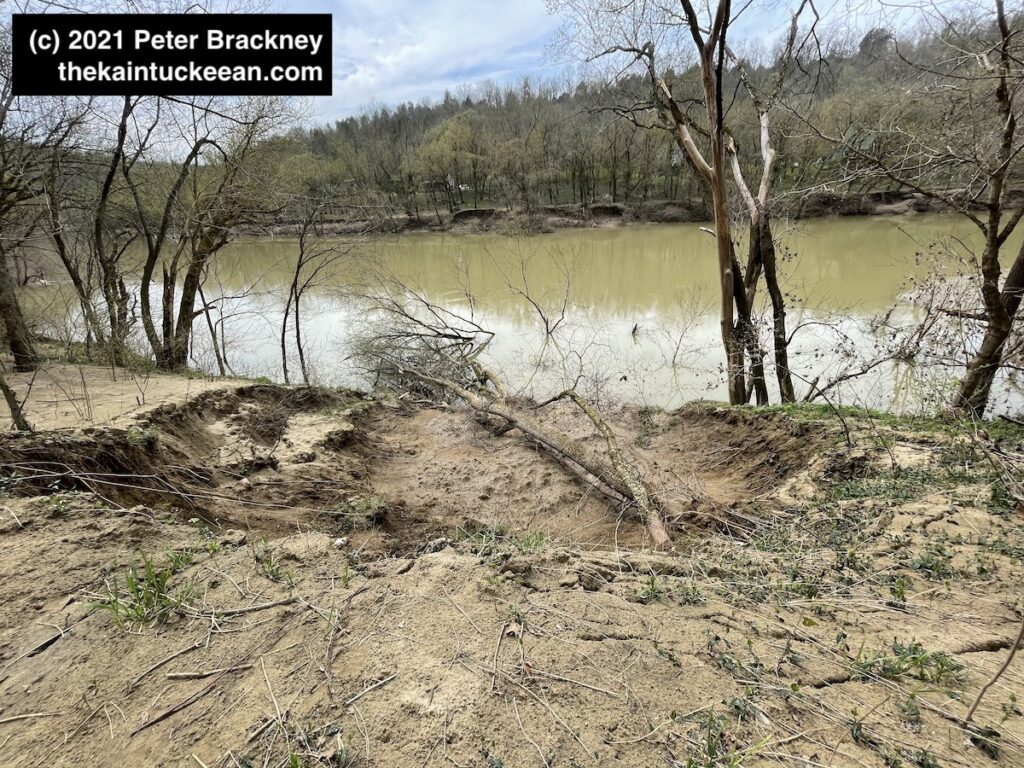
You can also see a new rut being created as the land evolves and the fresh rainwaters of March 2021 find their way to the Kentucky River. One final photograph of the land’s evolution is below showing the soil erosion adjacent to the trail as it runs alongside the river toward the spring, cave, and waterfall. Across the river, additional erosion was also visible.
