NoD: Alanant-O-Wamiowee

Maysville, KY
Historic Marker #84; Maysville, Ky.

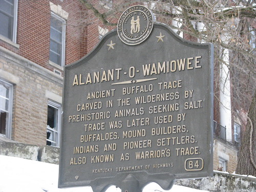
Kentucky Historic Marker #84 states that

Ancient buffalo trace carved in the wilderness by prehistoric animals seeking salt. Trace was later used by buffaloes, mound builders, Indians and pioneer settlers. Also known as Warrior’s Trace.

There are a couple of conflicting reports regarding the path of this particular trace. The historic marker, as well as Filson’s 1784 map, identify this trace as the “Warrior’s Trace” which generally heads south from Limestone n/k/a Maysville southeast before cutting through the Cumberland Gap; this is likely correct. But there are other sources, including the Kentucky Encyclopedia, labeling the Alanant-O-Wamiowee as the which have it going through what is now Big Bone Lick and crossing the Kentucky River near Leestown. This buffalo trace is located near and lends its name to what is now the Buffalo Trace Distillery. A third trace nearly paralleled the first until it reached the Blue Licks to turn southwest toward Lexington.

Regardless of the course, these traces were wide swathes of land cut into forest and leaving permanent paths where the large bison (and their now-extinct sister-species) would migrate. The paths were later used by armies and settlers, and more recently as road beds.

NoD: St. Patrick’s Parish

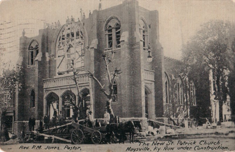
St. Patrick Catholic Church - Maysville, KY
St. Patrick Catholic Church; Maysville, Ky.

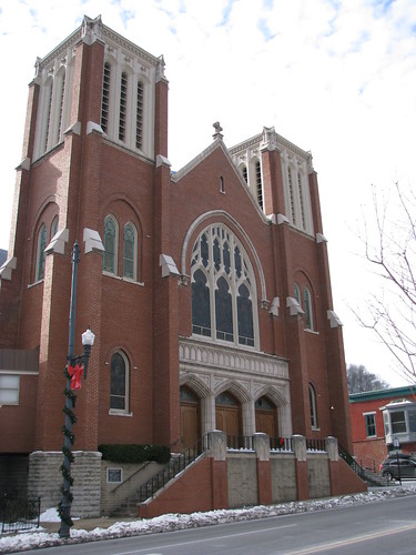
One of the first buildings I noticed in Maysville was the Catholic church. An impressive contemporary interpretation of the Romanesque style, St. Patrick’s Parish includes many Gothic qualities in its brick and stone construction. [*] In April 1901, Fr. Patrick M. Jones became the parish priest and found the parish and its buildings in poor condition. The existing parish church was all-brick and had been erected in 1849.

Fr. Jones had been born in County Limerick, Ireland in 1853 and emigrated to the United States in 1875. Ordained in the Covington Diocese in 1877, he ultimately came to his pastorate in Maysville. He worked tirelessly to grow the parish and to improve its buildings. On June 26, 1910, the present church was dedicated. It seats 1,200. The considerable sum raised for the church’s construction was $100,000; the church was built (as well as a school, cemetery expansion and so much more) in a rather quick period of time. To note, all this was done with little debt:

[*] It is a great testimony as to how the St. Patrick’s Parish grew. As I’ve found with Catholic churches, St. Patrick’s was open on a typical day for prayer and reflection. The altar is beautiful; check out my other flickr photos.

NoD: Don Gullett Country

IMG_5298
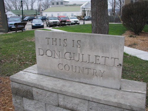
Don Gullett Country Memorial; Greenup, Ky.

On the lawn of the Greenup County is a memorial declaring that “This is Don Gullett Country.” I’ll be the first to admit, I didn’t recognize the name. I recognized the subject of he neighboring memorial, for Jesse Stuart, plus the Stuart memorial offered details as to who Stuart was.

I had to rely on Google to learn about Don Gullett, and I suppose if I were more of a baseball fan I might have recognized the name. Gullett was born in South Shore (Greenup County), Kentucky in 1951. Before he could drive, pro and college recruiters – baseball, football and basketball – were coming to Greenup County to watch him play at McKell High School. He skipped college and was drafted by the Cincinnati Reds in 1969. He played for the Reds for a few seasons before being picked up as a free agent by the New York Yankees.

During his pitching career, he won four consecutive World Series (1975, 1976 with the Reds; 1977, 1978 with the Yankees). His stats are available here. Gullett, suffering from shoulder injuries, retired from the game in 1979 and was released from the Yankees in 1980. He is enjoying retirement on a farm near his birthplace in South Shore.

NoD: Birthplace of General John Bell Hood

IMG_5324
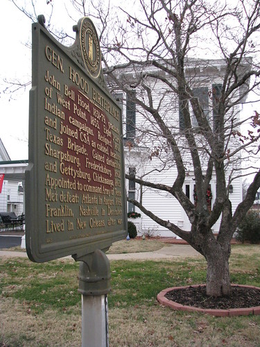
Birthplace of Gen. Hood, Owingsville, Ky.

General John Bell Hood was born in Owingsville, Kentucky in June, 1831. He served the Confederacy in the Civil War and did so with one of the most awesome beards in history. At Gettysburg, Hood (either by confusion or derelection) made a blunder which cost him the use of his arm. It also, arguably, cost the South a victory at Gettysburg and (given that the battle was the turning point of the War) the War. Am I exagerating history a little? Possibly.

We’ve highlighted this house before on the Kentucky120 visit to Owingsville, but inaccurately suggested that Hood was born in the house pictured; to clarify, he was born in a home that previously occupied the site. Yes, there is something about John Bell Hood that exudes hyperbole and exaggeration.

NoD: Margaret Garner (Kentucky Chautaqua)

The Bluegrass Trust hosts a monthly brown bag lunch lecture series at the John Hunt Morgan House. In celebration of Black History Month, this month’s event was held at the Downtown Arts Center and was a live one-person Kentucky Chataqua show from the Kentucky Humanities Council

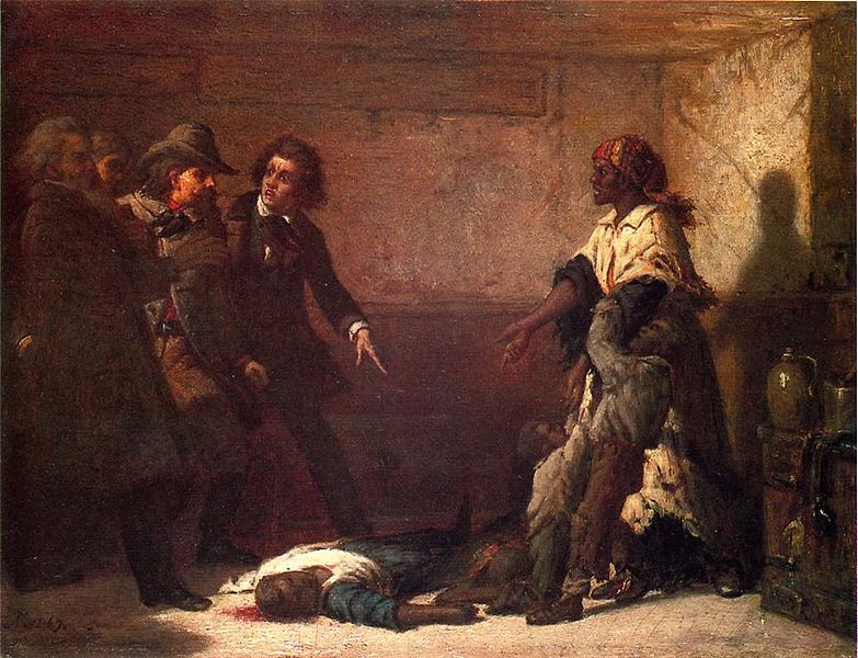
The Modern Medea, by Thomas Satterwhite Noble

Margaret Garner was a slave born in Boone County, Kentucky. Light-skinned, she was likely the daughter of her master – John P. Gaines (who was appointed by Pres. Zachary Taylor to be the governor of the Oregon Territory). When Gaines left her Oregon, he sold his farm, Maplewood (to which this post is geotagged), to his brother Archibald Gaines.

Archibald was a cruel master and ultimately, Margaret sought to escape with her three children. In the snowy winter of 1856, she escaped and crossed the frozen Ohio River, but was ultimately captured. Before her capture, however, she slit the throat of one of her children (she was stopped before she could kill the others) because she believed her children would be better in heaven than back in slavery. According to the story, Archibald was the father of each of her children and she didn’t want her daughters to be assaulted by their white masters.

Tried in Covington (rather than in Ohio), Garner was returned to slavery and sold down the river. The story of Margaret Garner was immediately well-known as it was publicized by both abolitionists (decrying the pathology of slavery) and pro-slavery forces (claiming that slaves were all subhuman). [*] The painting above, The Modern Medea, by Thomas Satterwhite Noble was inspired by Garner and was painted in 1867.  Her story was popularized again by Toni Morrison’s book, Beloved. Former UK professor research Garner, writing Modern Madea. There is also an opera about Garner which can be heard on NPR.

NoD: Limestone (n/k/a Maysville)

Maysville, KY
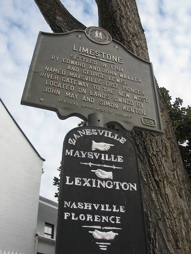
Waymarking Sign, Maysville, Ky.

Lexington’s Limestone Street travels north to merge with Paris Pike and its history is there forgotten. Ultimately, you can take the road all the way to the Ohio River at Maysville. And Limestone Street was once aptly named since Maysville was formerly known as Limestone. Limestone was first settled in 1784, the road to Lexington (an old buffalo trace) was almost immediately established. [*]

In 1787, Limestone was formally established by the Virginia General Assembly which changed the name of the community situated at the confluence of Limestone Creek and the Ohio River to Maysville. At the time, Limestone/Maysville was part of Bourbon County (and was until Mason County was created in 1789) and was a key riverport for the bourbon whiskey industry.

By 1833, Maysville was a thriving riverport and was made the county seat of Mason County in 1848 (it was a contentious vote, as Washington was previously the county seat). The name “Limestone” was used to identify the community until the mid-nineteenth century as well.

NoD: Nor’eastern Kentucky

Northeastern Kentucky
Nor’eastern Kentucky

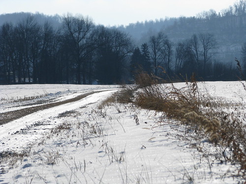
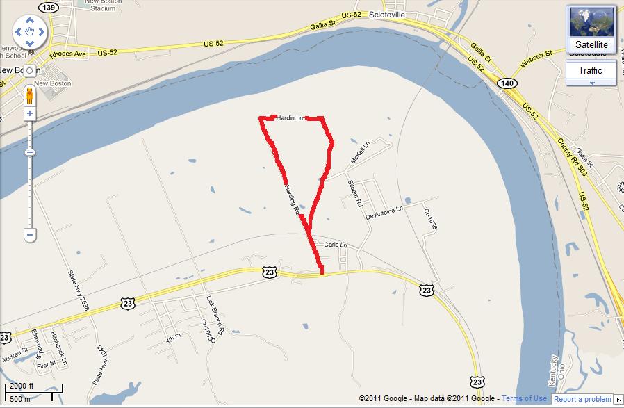
Greenup County is the most northeastern county in Kentucky as the Ohio River makes up its eastern and northern border. So in true No Destination spirit, I set out to go on Kentucky’s most northeastern road. Turns out, that is Hardin Lane. Snow covered and a little icy (especially for my Honda Fit), the road was beautiful. It seemed completely isolated, its flat farmland match by the rolling hills of southern Ohio across the river.

Apparently, switch grass is grown on some of this farmland; while driving I heard on  the radio that additional studies were needed to determine if this native vegetation is as efficient as coal as an energy source.

The map to the left shows where this road is – right off Route 23. Old tractors, chicken coops and other farming sites dot this little offroad. Check out my other flickr pictures of this little jaunt.

NoD: Shannoah

Shannoah
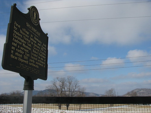
Shannoah Historic Marker, Greenup Co., Ky.

Following a flood destroying the Shannoah community on the north bank of the Ohio River, the Shawnee Indians came into Kentucky in 1750 and established a village by the same name. [*] At the time, the French laid claim to what would become central Kentucky as it claimed the entire Ohio River basin. Obviously, this would become one of the disputes between the French and the British which led to the French & Indian War.

Kentucky historic marker #31 reads:

First village in Kentucky built by Shawnee Indians and French traders. Visited in January 1751 by Christopher Gist, George Croghan, Andrew Montour, Robert Kallendar and a servant. Located on the site of an earlier Fort Ancient settlement, it stood 500 yards northwest of these Hopewell earthworks.

The journal of Christopher Gist is a significant resource that tells of the 1751 visit to Shannoah by Gist and his colleagues. He “killed a fat Bear” on March 6, 1750. Gist would later guide Major George Washington on missions during the French & Indian War.

At the time of Gist’s visit, inhabitants of Shannoah numbered 300 men in about 40 houses. [*]

NoD: U.S. Grant Bridge

U.S. Grant Bridge
U.S. Grant Bridge spans the Ohio River; Greenup County, Ky.

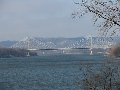
A spectacular bridge spans the Ohio River at South Portsmouth, Kentucky (and Portsmouth, Ohio) and carries U.S. 23 traffic to and from Kentucky. The current bridge opened to traffic on October 16, 2006, after five years of construction. The original U.S. Grant Bridge was built in 1927 and was demolished in 2001.

Named after General (and later the eighteenth President) Ulysses S. Grant, the bridge is a cable-stayed bridge that cost over $38 million to construct. The two-lane bridge is 2,155 feet in length. [*] Check out these other pictures of the US Grant Bridge!

NoD: Jack Jouett, Jr.

IMG_5344
Jack Jouett Historic Marker, Owingsville, Ky.

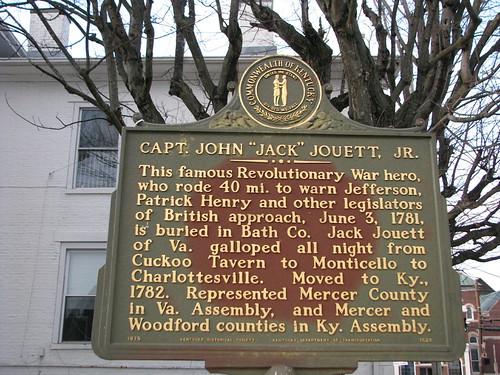
Henry Wadsworth Longfellow’s immortal poem begins, “Listen my children and you shall hear of the midnight ride of Paul Revere.” His words “one if by land, two if by sea” captured forever Paul Revere into America’s folklore. He is believed a great father of American independence.

But what of the other hero who made a similar ride? In early June 1781, Jack Jouett – asleep in Cuckoo, Louisa County, Virginia – heard British troops and quickly determined their destination: Charlottesville. Jouett took to his horse and rode the 40 miles to warn Governor Thomas Jefferson and the legislature (which had been convened in Charlottesville due to Benedict Arnold’s taking of Richmond).

Arriving hours before the British, Jouett first rode to Jefferson’s home, Monticello, where he successfully warned the Governor and those legislators staying there. Jouett then rode the additional two miles to Charlottesville and warned the balance of the legislature. All but seven legislators successfully escaped thanks to Jouett’s heroics. (Jefferson leisurely stayed at Monticello and escaped himself by horseback with only second to spare, but Jouett definitely warned him!)

Soon after, Jouett moved to Kentucky County. Passing a cabin on his way through the Wilderness Pass, Jouett hears a woman scream. He broke into the cabin only to find her being beaten by her husband and began to separate the two, but the woman defended her husband by taking a cast iron skillet to Jouett’s head. Fortunately, the skillet was of low grade and the bottom fell through, but Jouett rode on until he could find a blacksmith to release the remainder of the pan from his head. [*]

Settling first in what is now Mercer County, Jouett ultimately moved to Woodford County. He served in both the Virginia and Kentucky legislatures on behalf of Kentuckians and he aided in Kentucky’s first constitutional convention. He died while visiting his daughter in what-is-now Bath County and was buried in an unmarked grave at the “Peeled Oak” farm.